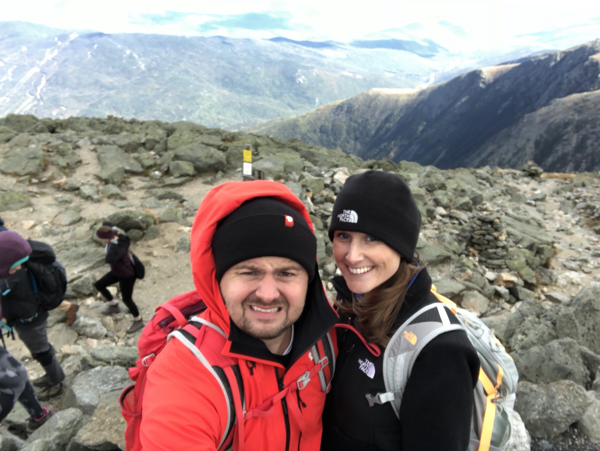
We climbed Mt. Washington!
Mt. Washington is the highest peak in the Northeastern United States at 6,288.2
ft.
The mountain is known for its erratic weather and is accessible by climbing, the auto road and the cog train.
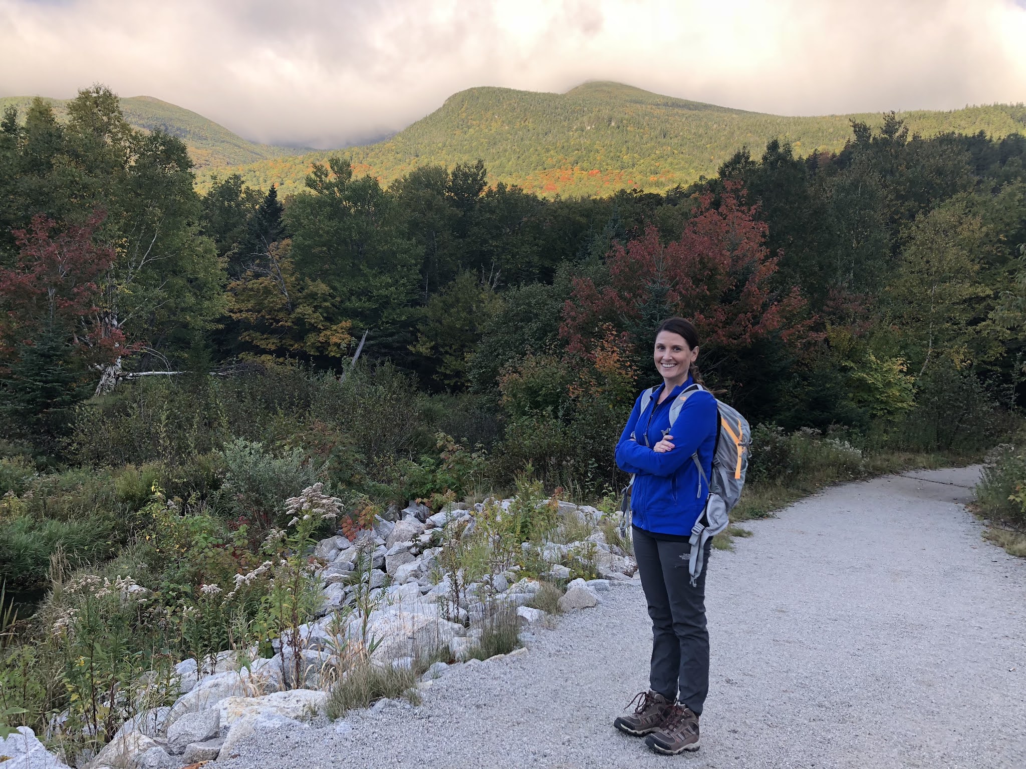
Mt. Washington is an 8+ hour drive from where we live in Pennsylvania. We took a long weekend to make the trip up there just to climb the mountain at the end of September (2018).
Where we stayed:
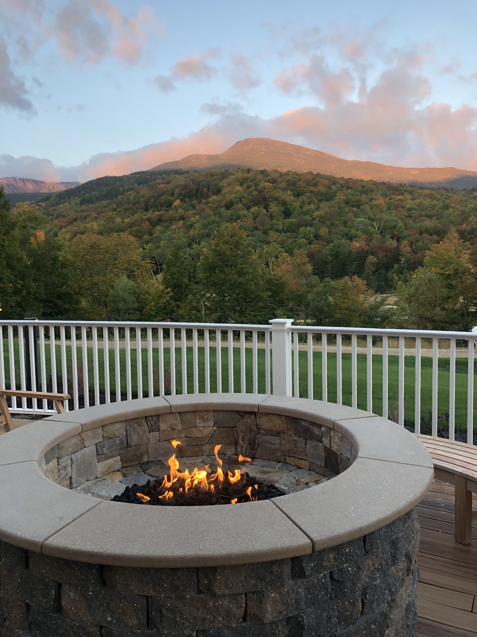
We stayed at a brand new hotel calledThe Glen House. In fact, it was there grand opening weekend when we stayed there. We LOVED this hotel and can’t recommend it enough! We chose this hotel because it was close by to Pinkham Notch, where we would be starting our hike. We honestly
can’t wait to go back here soon!

Where to eat:
We
had breakfast, dinner and drinks at the hotel restaurant “The Notch
Grille”. The views of the mountain from this hotel are amazing (which
you will see from our pictures)!
Where we parked for the hike:
We parked at the AMC Pinkham Notch Visitor Center Parking Lot.

AMC Pinkham Notch/Tuckerman Ravine Trail:
At the
trail head, there is parking, restrooms, and a visitor center where you can
purchase trail maps, snacks, and drinks.
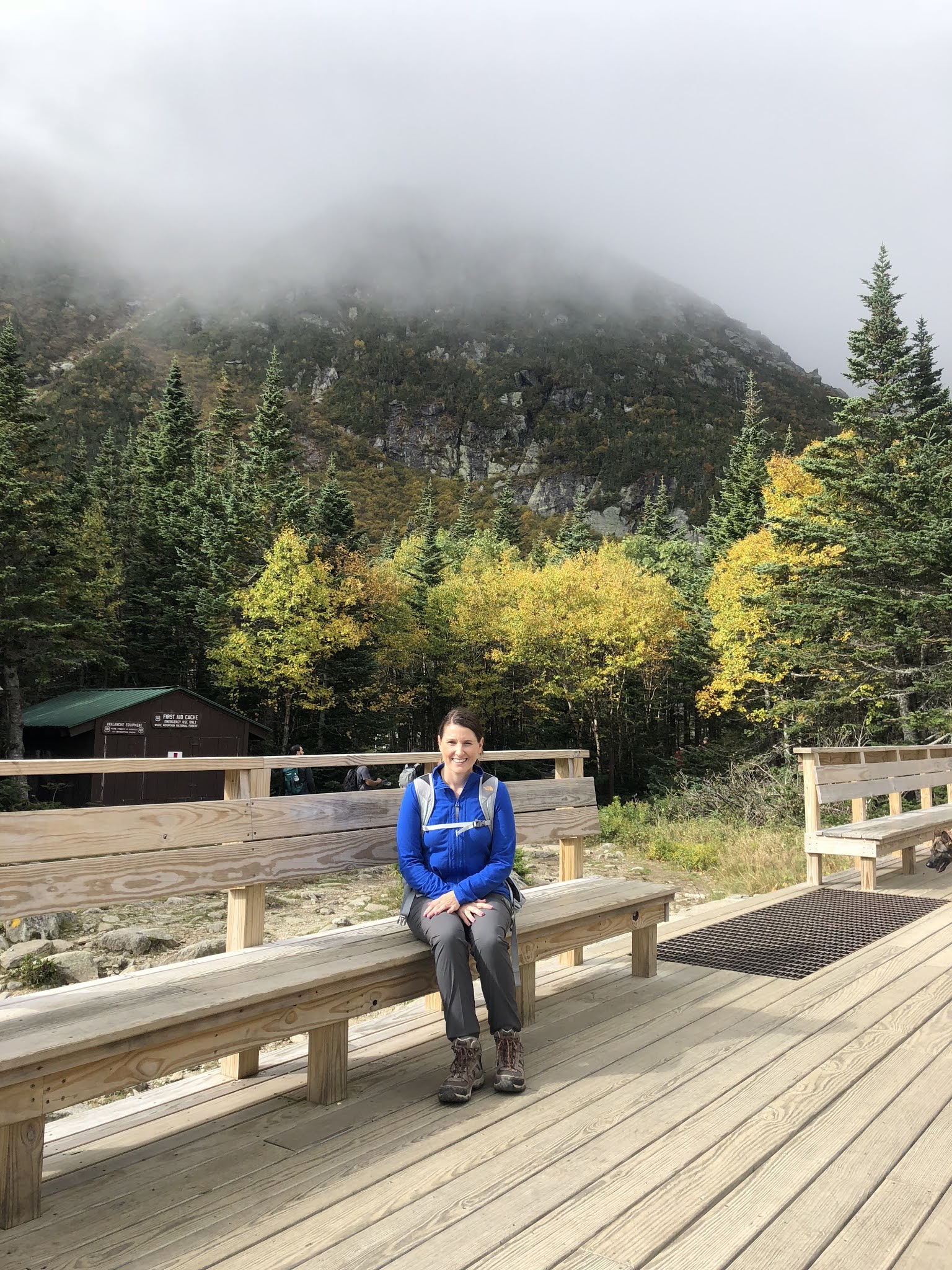
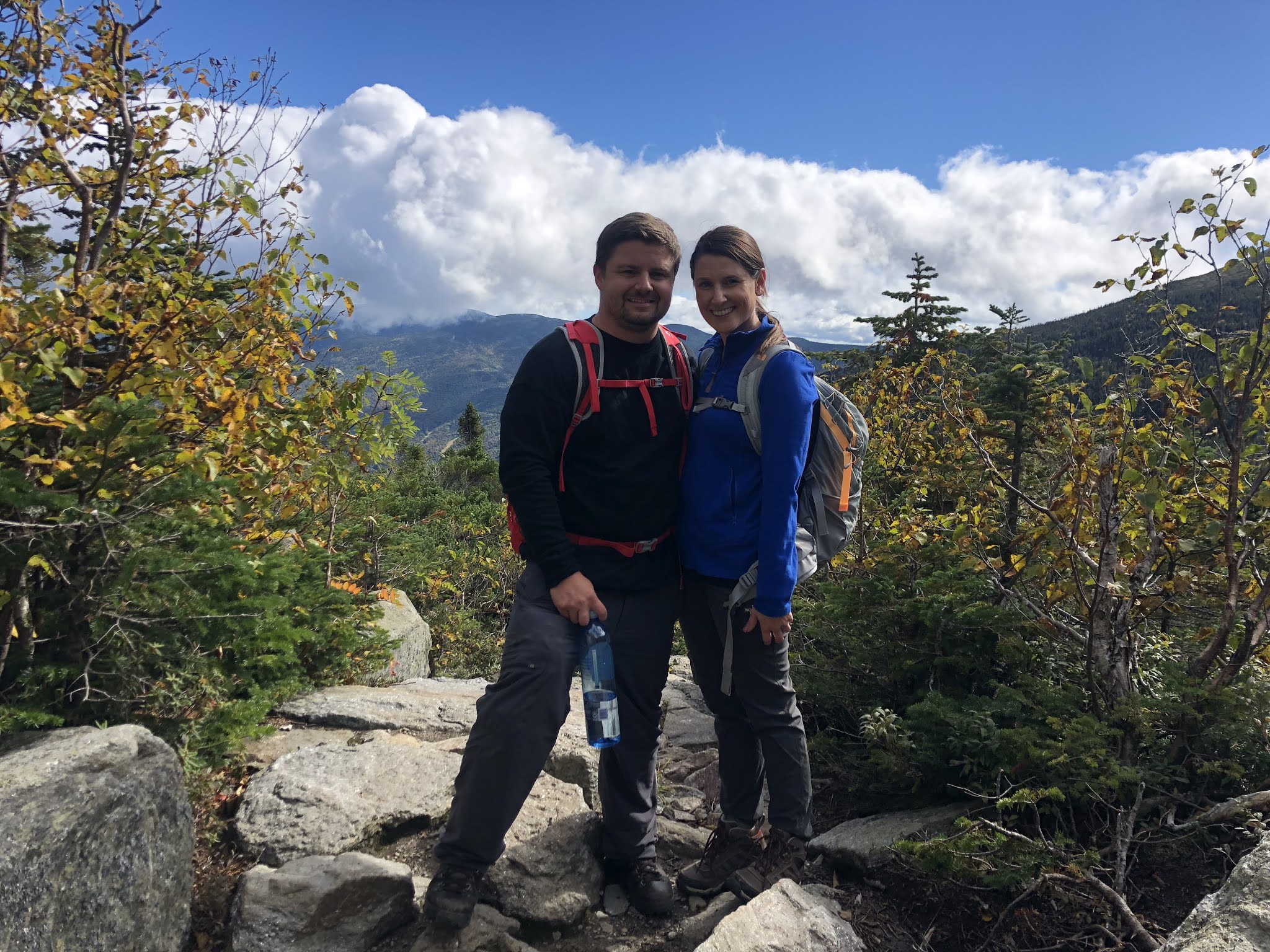
After
gearing up, we began our climb at 7:30 am via Tuckerman Ravine. The trail
starts with a gradual ascend of a rock covered trail that makes its way through
dense pine and crosses over various bridges. Expect to hike for about an hour
or so before arriving at the Tuckerman Ravine Shelter. Here you will find
restrooms and a place to stop and take a rest.
This Shelter also serves as a
hub for the different trail heads. Lions head and Boott Spur are some of the
other trails that begin at this location. Most people ascend the mountain via
Tuckerman Ravine. Lions head is the second most popular and Boot Spur is
the least traveled. If you are an experienced hiker, we have heard Boott Spur has some of the
best views of any trail and leads to the “lake of the clouds”.
We rested at the
shelter for around 30 mins before continuing up Tuckerman Ravine. The trail
gradually became steeper as we climbed to the bottom of the headwall. The
headwall is a 4,400 ft cliff face that takes you above the tree line.
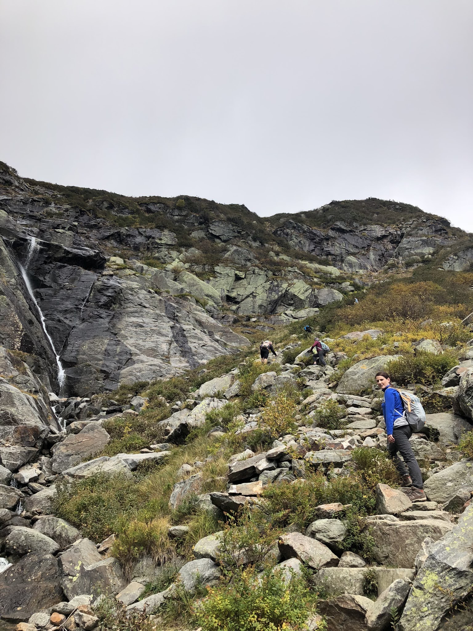
This part
of the climb is one of the most challenging parts of the entire hike/climb. It was not
uncommon to pass someone who had given up and turned back. Once at the top of
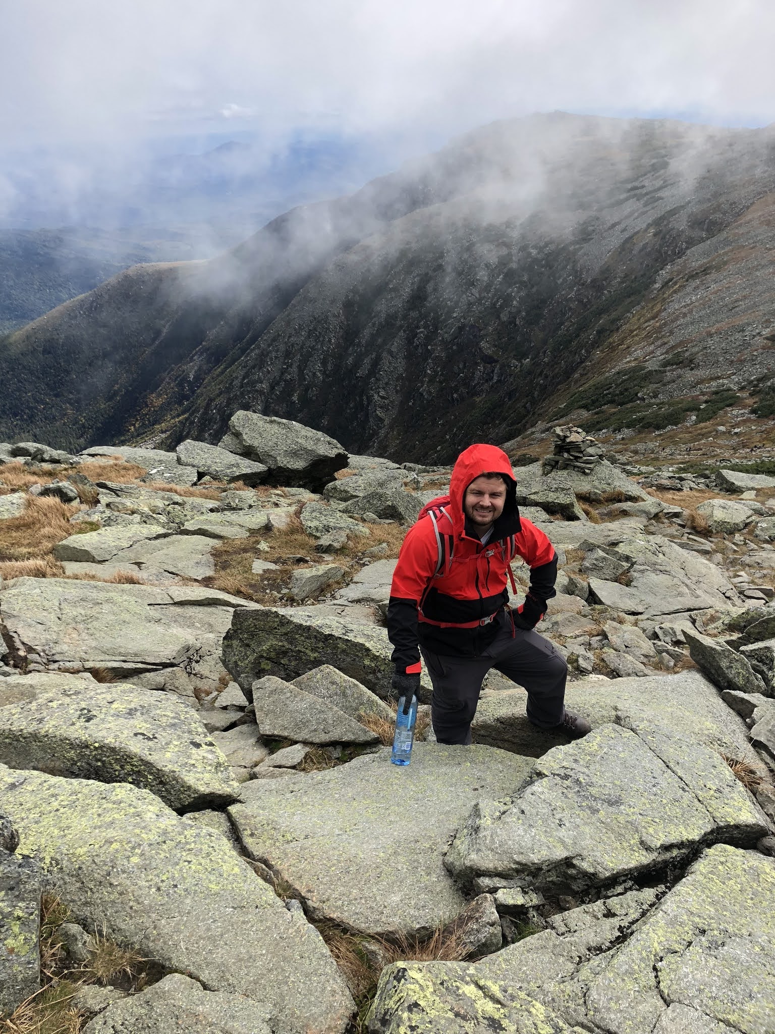
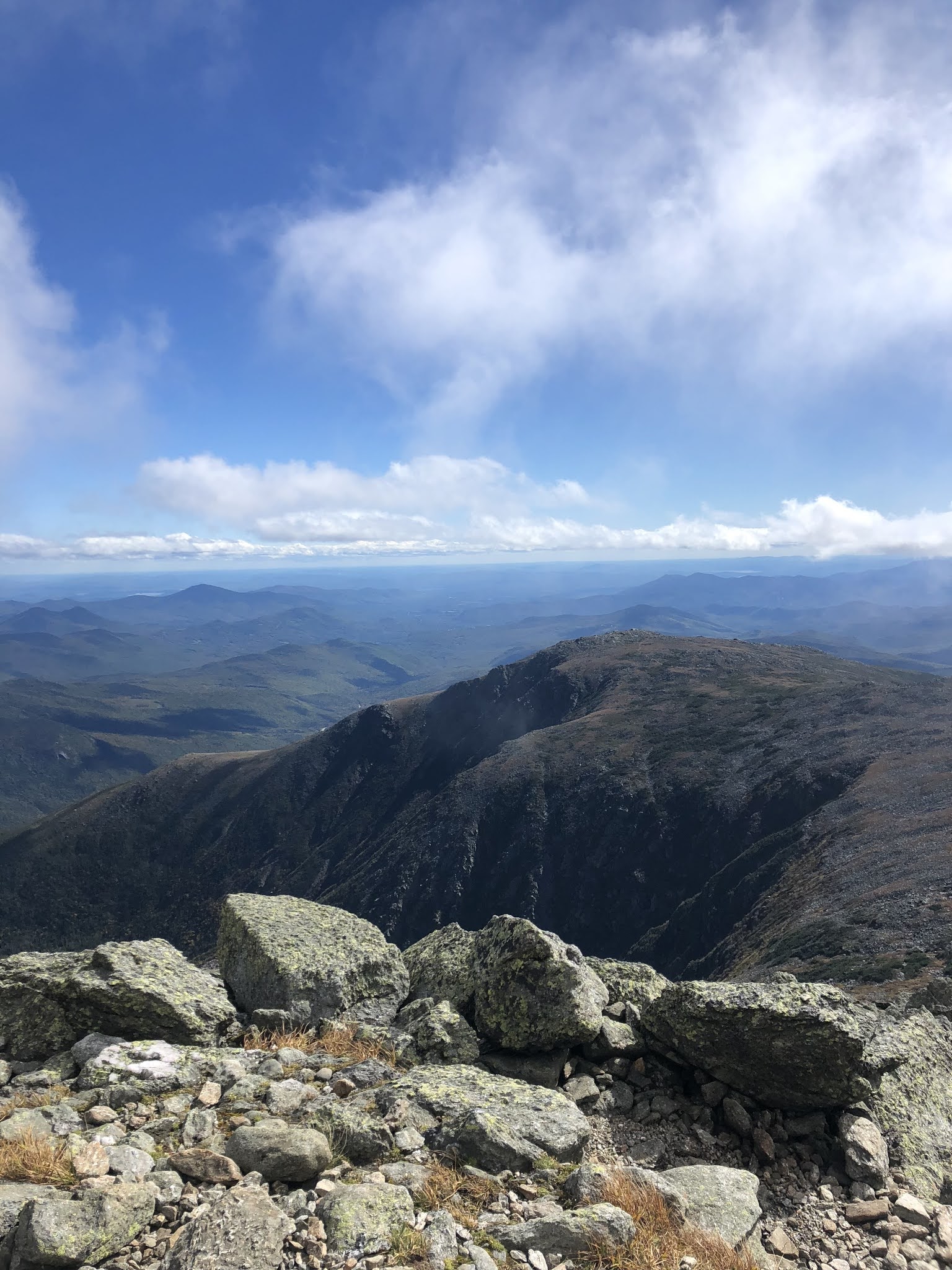
the headwall, you can really get a sense of the vast surrounding landscape. At
this point, most of our energy had been drained. From the top of the headwall,
the summit is about an hour of intense climbing. What made it worse was the
drastic change in weather. When we started the climb, it was a comfortable 65
degrees. At this point in our climb, we were battling 40mph winds and a
temperature that felt like 20 degrees. Exhausted, cold, but determined we
pushed for the summit. Every 10 steps felt like running a mile. We remember
looking at our altimeter and counting down the ft to the top.
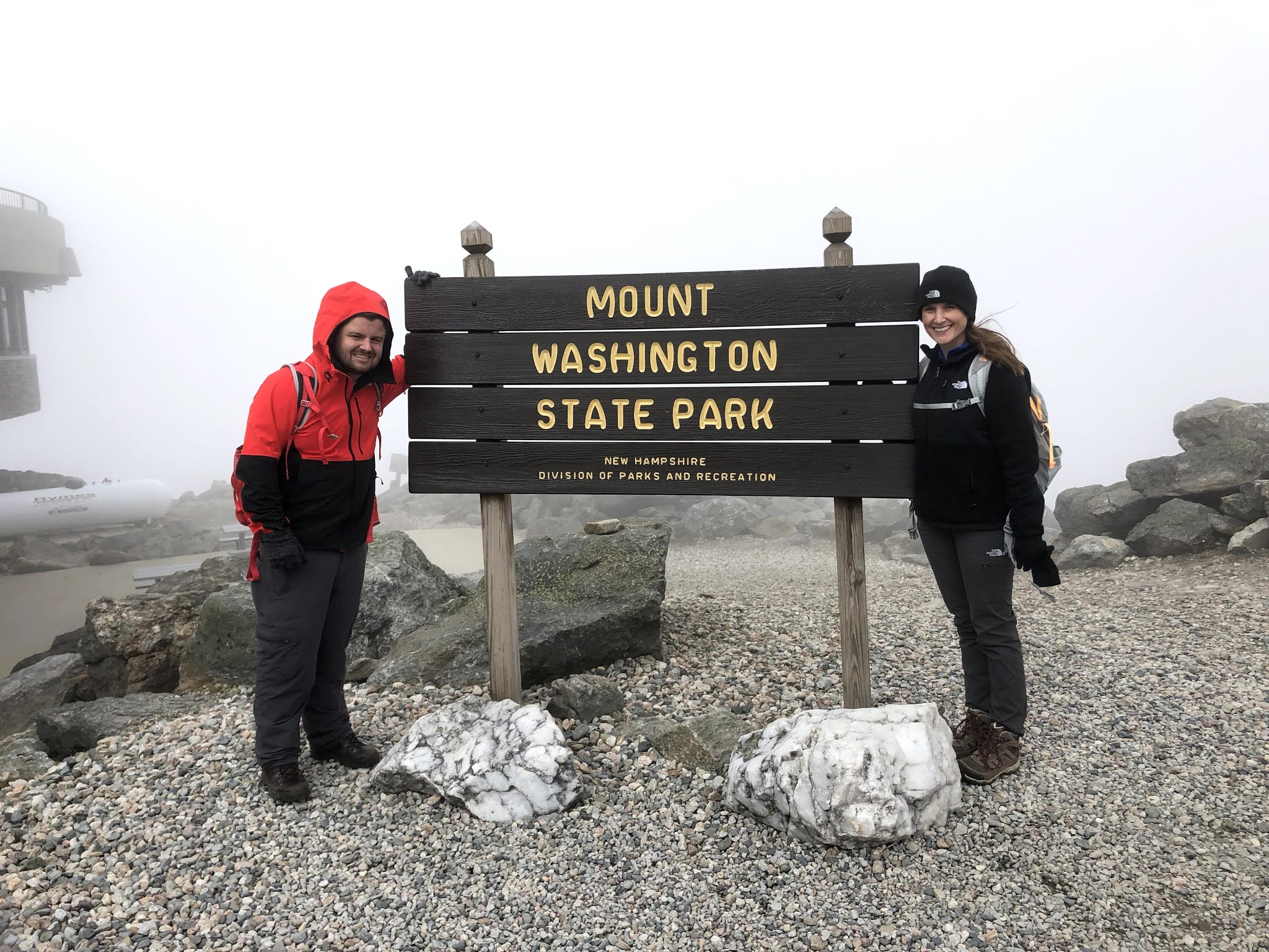
When we finally
got to the top, we celebrated our accomplishment! It took us about 4.5 hrs to
reach the summit. We
had originally planned to hike up AND down the mountain, but chose to take a shuttle from the summit back to AMC Pinkham
Notch due to not meeting our anticipated turnaround time. The
shuttle service is available from The Station Gift Shop. The shuttle fills up quickly for the day,
so be sure to book it ahead of time or as soon as you reach the summit! Once we finished exploring the summit and state park, we got in the shuttle for the 30 minute ride down the Mt. Washington Access Road.
More information on The Summit:
- Mt. Washington State Park – trails
- The Cog Train – you can check out more information about the cog train here. The cog train station is located at the western face of Mount Washington.
- Mount Washington Observatory/Weather Station – Did you know…you can actually camp at the weather station!? More information here.
- Tip Top House Historic Site – This is a historic former hotel built in 1853 and is the oldest surviving building in the summit area.
- Auto Road Access
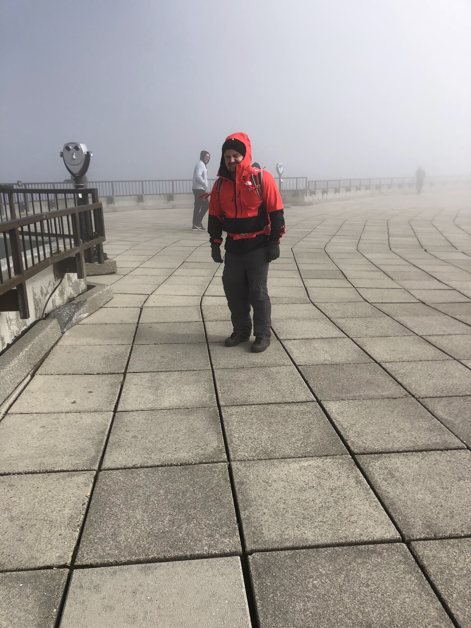
Weather:
As we mentioned above, it
was the end of September so it was a beautiful fall day (65 degrees) at
the start of our hike and for most of the duration. As we mentioned
earlier, the summit is well known for its erratic weather changes, so
once we reached the top, it was 20 degrees!
How to pack:
We each had a backpack with water, snacks, a sweatshirt, winter jacket, gloves and a hat. You’ll find that you’ll need to add layers as you near the summit. We started out hiking in a t-shirt and were wearing our winter jackets by the time we reached the top.
Click here to read about the next mountain we conquered – Mount Mitchel – the highest peak east of the Mississippi River! We cover our weekend itinerary in Asheville, NC at the Biltmore and how we planned out our hike at Mount Mitchel!